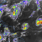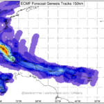
Invest95L drifts toward Gulf of Mexico, chances for tropical development increases
The National Hurricane Center is tracking three different areas for potential tropical development. The closest to the United States is Invest 95L Cu rent model guidance suggests that Invest 95L will drift into the Gulf of Mexico in coming days and that the chances for development – in the available model data, not the official forecast – are between 50-… Read more →