NOAA Storm Prediction Center Mesoscale Discussion 679
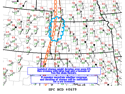
MD 0679 CONCERNING SEVERE POTENTIAL…WATCH POSSIBLE FOR NWRN KS AND EXTREME SWRN NEB MESOSCALE DISCUSSION 0679 NWS STORM PREDICTION CENTER NORMAN OK 0545 PM CDT SUN MAY 22 2016 AREAS AFFECTED…NWRN KS AND EXTREME SWRN NEB CONCERNING…SEVERE POTENTIAL…WATCH POSSIBLE VALID 222245Z – 230045Z PROBABILITY OF WATCH ISSUANCE…40 PERCENT SUMMARY…SOME POTENTIAL EXISTS FOR ISOLATED STORMS TO INITIATE OVER NWRN KS THIS… Read more →


