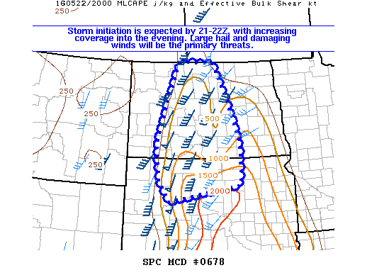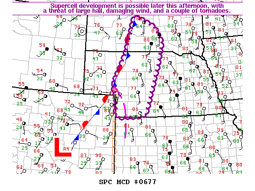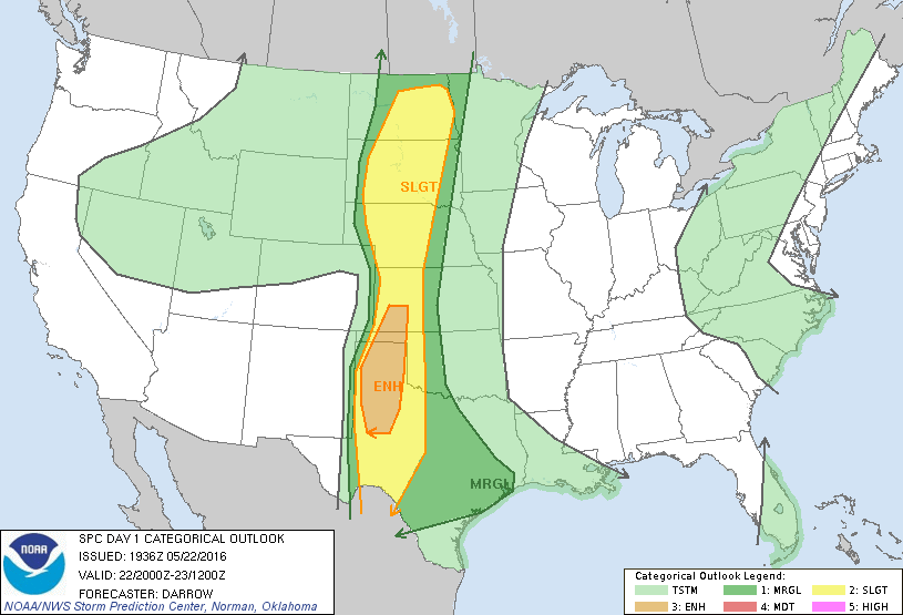
Storm Prediction Center May 22, 2016 Afternoon Outlook
SPC 2000Z Day 1 Outlook DAY 1 CONVECTIVE OUTLOOK NWS STORM PREDICTION CENTER NORMAN OK 0236 PM CDT SUN MAY 22 2016 VALID 222000Z – 231200Z …THERE IS AN ENH RISK OF SEVERE THUNDERSTORMS ACROSS THE CENTRAL AND SOUTHERN HIGH PLAINS… …THERE IS A SLGT RISK OF SEVERE THUNDERSTORMS ACROSS THE GREAT PLAINS… …THERE IS A MRGL RISK OF SEVERE… Read more →