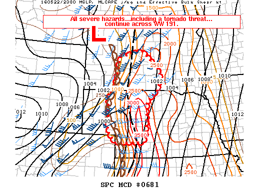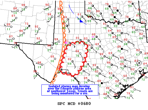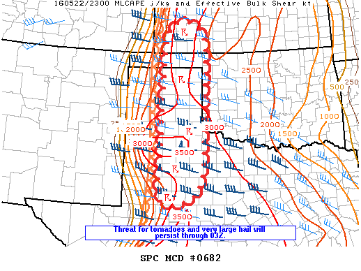
NOAA Storm Prediction Center Mesoscale Discussion 682
MD 0682 CONCERNING TORNADO WATCH 190… FOR WRN TX…OK PANHANDLE AND SWRN KS MESOSCALE DISCUSSION 0682 NWS STORM PREDICTION CENTER NORMAN OK 0702 PM CDT SUN MAY 22 2016 AREAS AFFECTED…WRN TX…OK PANHANDLE AND SWRN KS CONCERNING…TORNADO WATCH 190… VALID 230002Z – 230200Z THE SEVERE WEATHER THREAT FOR TORNADO WATCH 190 CONTINUES. SUMMARY…THREAT FOR VERY LARGE HAIL…TORNADOES AND DAMAGING WIND… Read more →