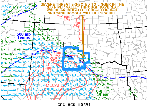
NOAA Storm Prediction Center Mesoscale Discussion 691
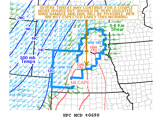
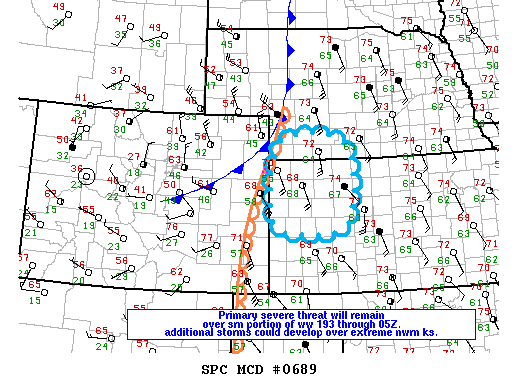
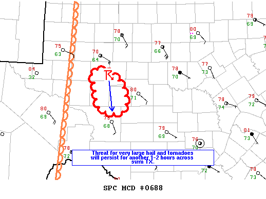
MD 0691 CONCERNING SEVERE THUNDERSTORM WATCH 196… FOR SRN OK…NORTH TX MESOSCALE DISCUSSION 0691 NWS STORM PREDICTION CENTER NORMAN OK 0136 AM CDT MON MAY 23 2016 AREAS AFFECTED…SRN OK…NORTH TX CONCERNING…SEVERE THUNDERSTORM WATCH 196… VALID 230636Z – 230800Z THE SEVERE WEATHER THREAT FOR SEVERE THUNDERSTORM WATCH 196 CONTINUES. SUMMARY…A SEVERE THREAT WILL BE POSSIBLE THROUGH DAYBREAK IN THE RED… Read more →