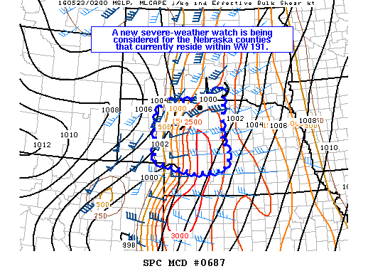
NOAA Storm Prediction Center Mesoscale Discussion 687
MD 0687 CONCERNING TORNADO WATCH 191… FOR MUCH OF CENTRAL NEBRASKA MESOSCALE DISCUSSION 0687 NWS STORM PREDICTION CENTER NORMAN OK 0926 PM CDT SUN MAY 22 2016 AREAS AFFECTED…MUCH OF CENTRAL NEBRASKA CONCERNING…TORNADO WATCH 191… VALID 230226Z – 230400Z THE SEVERE WEATHER THREAT FOR TORNADO WATCH 191 CONTINUES. SUMMARY…A NEW SEVERE-WEATHER WATCH IS BEING CONSIDERED FOR THE NEBRASKA COUNTIES THAT… Read more →