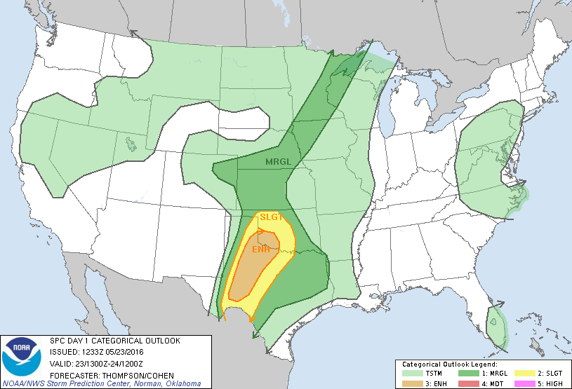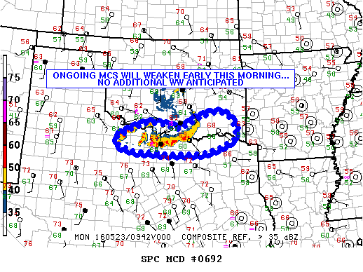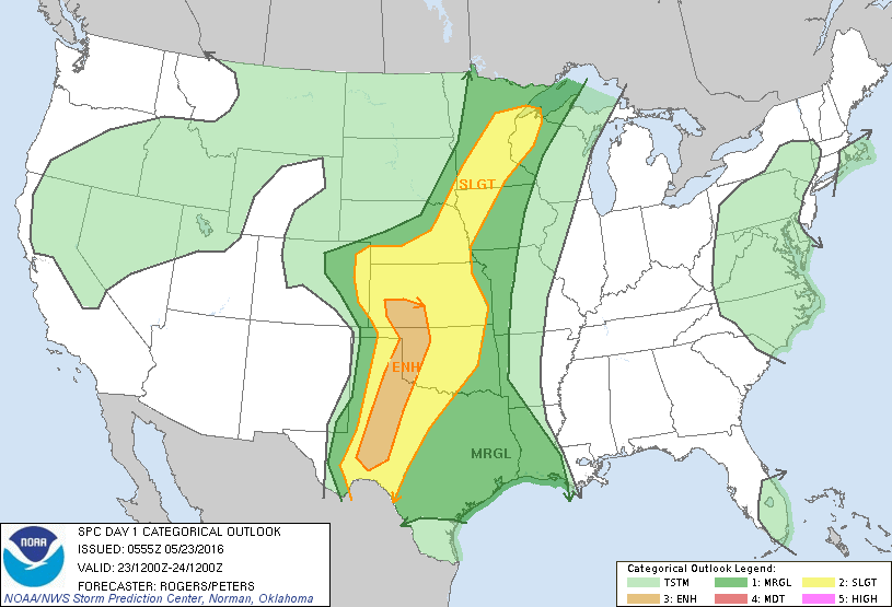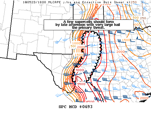
NOAA Storm Prediction Center Mesoscale Discussion 693
MD 0693 CONCERNING SEVERE POTENTIAL…TORNADO WATCH LIKELY FOR PARTS OF WEST TX MESOSCALE DISCUSSION 0693 NWS STORM PREDICTION CENTER NORMAN OK 0132 PM CDT MON MAY 23 2016 AREAS AFFECTED…PARTS OF WEST TX CONCERNING…SEVERE POTENTIAL…TORNADO WATCH LIKELY VALID 231832Z – 232030Z PROBABILITY OF WATCH ISSUANCE…95 PERCENT SUMMARY…ISOLATED TO WIDELY SCATTERED STORMS SHOULD DEVELOP OVER THE MOUNTAINS OF THE TRANS-PECOS AND… Read more →