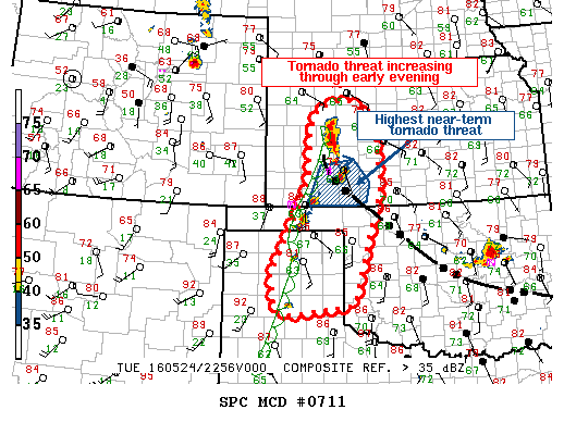
NOAA Storm Prediction Center Mesoscale Discussion 713
MD 0713 CONCERNING SEVERE POTENTIAL…WATCH NEEDED SOON FOR CNTRL KS MESOSCALE DISCUSSION 0713 NWS STORM PREDICTION CENTER NORMAN OK 0715 PM CDT TUE MAY 24 2016 AREAS AFFECTED…CNTRL KS CONCERNING…SEVERE POTENTIAL…WATCH NEEDED SOON VALID 250015Z – 250045Z PROBABILITY OF WATCH ISSUANCE…95 PERCENT SUMMARY…TSTMS ARE QUICKLY DEVELOPING ALONG/N OF A REMNANT OUTFLOW BOUNDARY…ALONG THE ERN EDGE OF TORNADO WATCH 204. A… Read more →