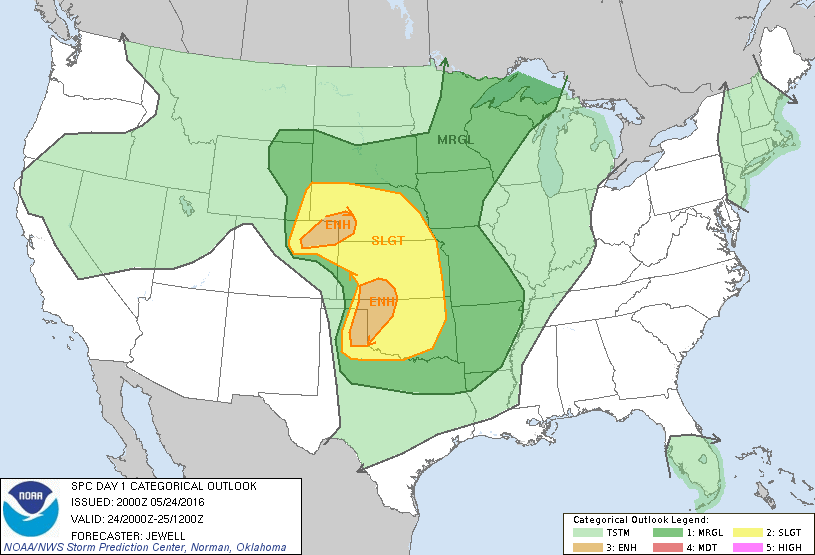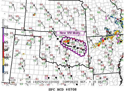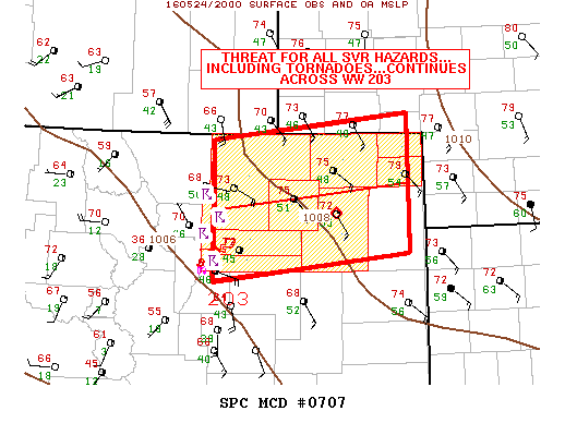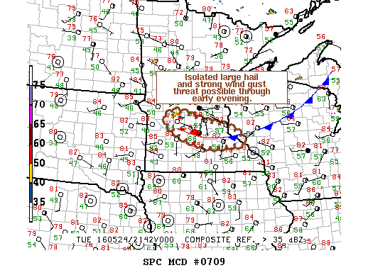
NOAA Storm Prediction Center Mesoscale Discussion 709
MD 0709 CONCERNING SEVERE POTENTIAL…WATCH UNLIKELY FOR PARTS OF CNTRL MN MESOSCALE DISCUSSION 0709 NWS STORM PREDICTION CENTER NORMAN OK 0455 PM CDT TUE MAY 24 2016 AREAS AFFECTED…PARTS OF CNTRL MN CONCERNING…SEVERE POTENTIAL…WATCH UNLIKELY VALID 242155Z – 242300Z PROBABILITY OF WATCH ISSUANCE…20 PERCENT SUMMARY…AN ISOLATED LARGE-HAIL AND STRONG WIND-GUST THREAT MAY ACCOMPANY A MATURING STORM ACROSS CNTRL MN THROUGH… Read more →