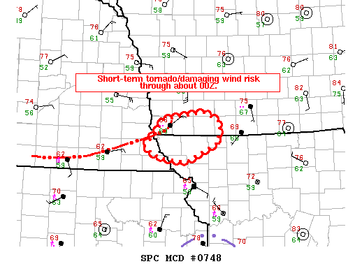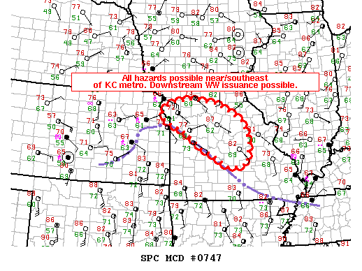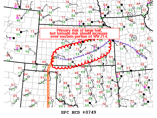
NOAA Storm Prediction Center Mesoscale Discussion 749
MD 0749 CONCERNING TORNADO WATCH 214… FOR SOUTH KS MESOSCALE DISCUSSION 0749 NWS STORM PREDICTION CENTER NORMAN OK 0555 PM CDT THU MAY 26 2016 AREAS AFFECTED…SOUTH KS CONCERNING…TORNADO WATCH 214… VALID 262255Z – 270030Z THE SEVERE WEATHER THREAT FOR TORNADO WATCH 214 CONTINUES. SUMMARY…PRIMARY SEVERE THREAT SHOULD REMAIN IN THE FORM OF LARGE HAIL…BUT THE RISK FOR A TORNADIC… Read more →