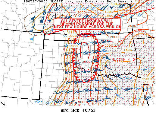
NOAA Storm Prediction Center Mesoscale Discussion 753
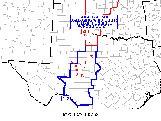
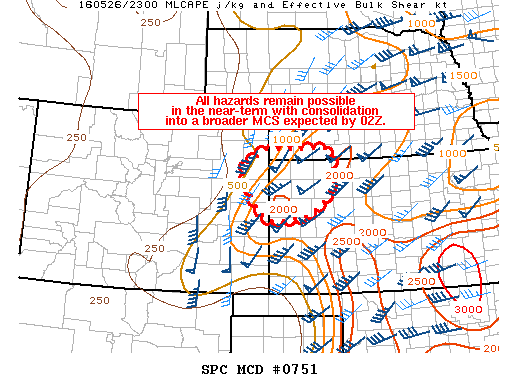
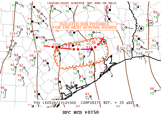
MD 0753 CONCERNING TORNADO WATCH 214… FOR WRN OK…NW TX MESOSCALE DISCUSSION 0753 NWS STORM PREDICTION CENTER NORMAN OK 0746 PM CDT THU MAY 26 2016 AREAS AFFECTED…WRN OK…NW TX CONCERNING…TORNADO WATCH 214… VALID 270046Z – 270145Z THE SEVERE WEATHER THREAT FOR TORNADO WATCH 214 CONTINUES. SUMMARY…ALL SEVERE HAZARDS REMAIN POSSIBLE ACROSS WRN OK FOR THE NEXT FEW HOURS. DISCUSSION…REGIONAL… Read more →