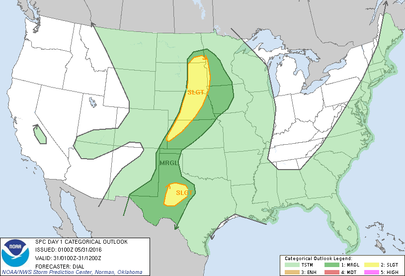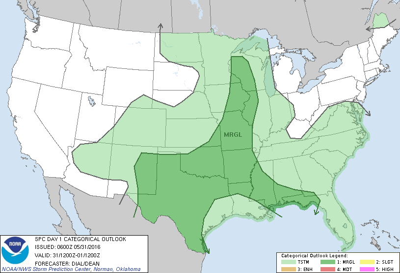
Storm Prediction Center May 31, 2016 Early Morning UTC Day 1 Convective Outlook
SPC 1200Z Day 1 Outlook DAY 1 CONVECTIVE OUTLOOK NWS STORM PREDICTION CENTER NORMAN OK 0100 AM CDT TUE MAY 31 2016 VALID 311200Z – 011200Z …THERE IS A MRGL RISK OF SEVERE THUNDERSTORMS FROM THE SRN PLAINS THROUGH THE MS VALLEY AND GULF COAST REGION… …SUMMARY… ISOLATED STRONG TO SEVERE THUNDERSTORMS ARE EXPECTED THIS AFTERNOON INTO EARLY EVENING FROM… Read more →