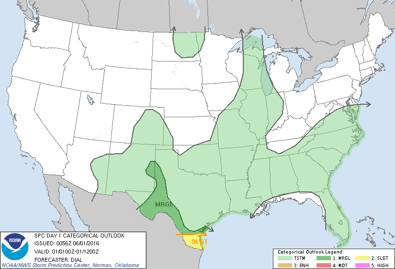
Storm Prediction Center Jun 1, 2016 UTC Evening Outlook
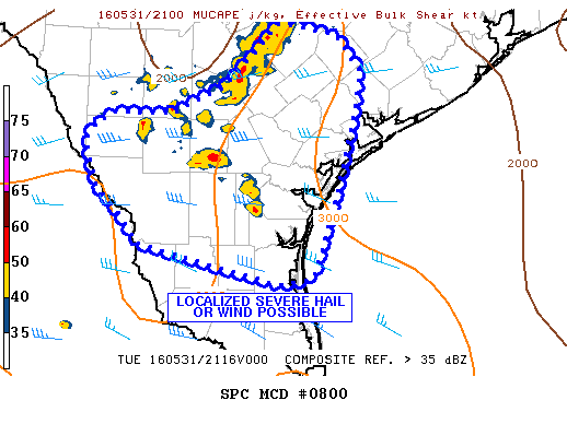
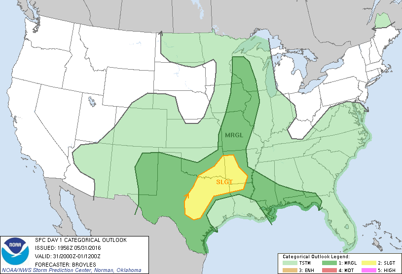
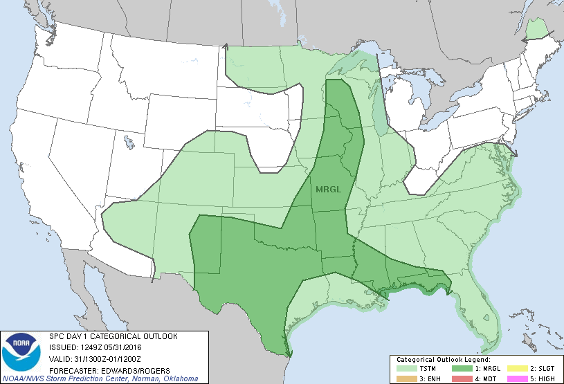
SPC 0100Z Day 1 Outlook DAY 1 CONVECTIVE OUTLOOK NWS STORM PREDICTION CENTER NORMAN OK 0756 PM CDT TUE MAY 31 2016 VALID 010100Z – 011200Z …THERE IS A SLGT RISK OF SEVERE THUNDERSTORMS OVER DEEP SOUTH TX… …THERE IS A MRGL RISK OF SEVERE THUNDERSTORMS FROM SRN THROUGH WRN TX AND ERN NM… …SUMMARY… A FEW STRONG TO SEVERE… Read more →