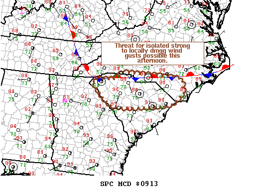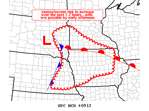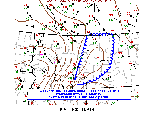
NOAA Storm Prediction Center Mesoscale Discussion 914
MD 0914 CONCERNING SEVERE POTENTIAL…WATCH UNLIKELY FOR PORTIONS OF CENTRAL MT MESOSCALE DISCUSSION 0914 NWS STORM PREDICTION CENTER NORMAN OK 0200 PM CDT TUE JUN 14 2016 AREAS AFFECTED…PORTIONS OF CENTRAL MT CONCERNING…SEVERE POTENTIAL…WATCH UNLIKELY VALID 141900Z – 142100Z PROBABILITY OF WATCH ISSUANCE…20 PERCENT SUMMARY…DEVELOPING THUNDERSTORMS MAY CAUSE A FEW STRONG/SEVERE WIND GUSTS THIS AFTERNOON INTO THIS EVENING. HOWEVER…WATCH ISSUANCE… Read more →