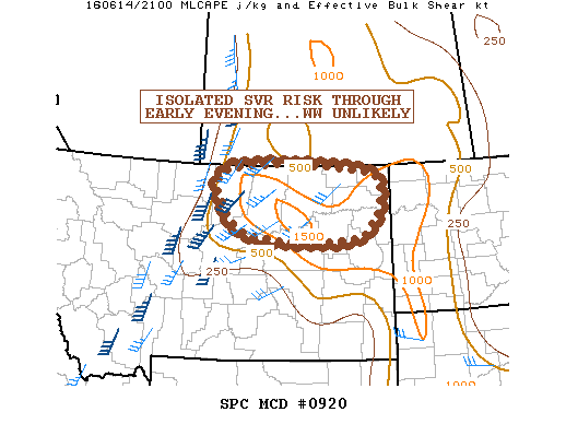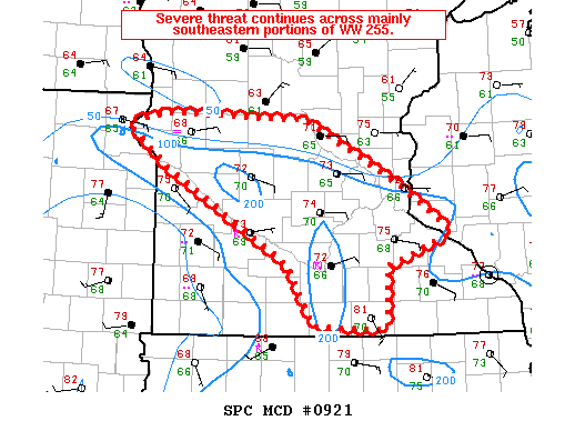
NOAA Storm Prediction Center Mesoscale Discussion 921
MD 0921 CONCERNING TORNADO WATCH 255… FOR FAR NERN SD…PARTS OF CNTRL/SRN MN…AND FAR WRN WI MESOSCALE DISCUSSION 0921 NWS STORM PREDICTION CENTER NORMAN OK 0516 PM CDT TUE JUN 14 2016 AREAS AFFECTED…FAR NERN SD…PARTS OF CNTRL/SRN MN…AND FAR WRN WI CONCERNING…TORNADO WATCH 255… VALID 142216Z – 142315Z THE SEVERE WEATHER THREAT FOR TORNADO WATCH 255 CONTINUES. SUMMARY…SEVERE THREAT… Read more →