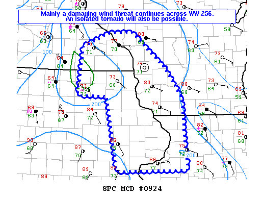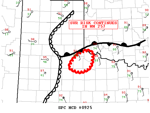
NOAA Storm Prediction Center Mesoscale Discussion 925
MD 0925 CONCERNING TORNADO WATCH 257… FOR A SMALL PART OF WRN N TX AND THE ERN TX S PLAINS…FAR SWRN OK MESOSCALE DISCUSSION 0925 NWS STORM PREDICTION CENTER NORMAN OK 0656 PM CDT TUE JUN 14 2016 AREAS AFFECTED…A SMALL PART OF WRN N TX AND THE ERN TX S PLAINS…FAR SWRN OK CONCERNING…TORNADO WATCH 257… VALID 142356Z -… Read more →