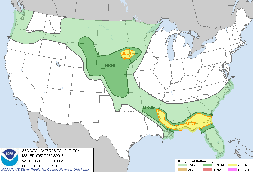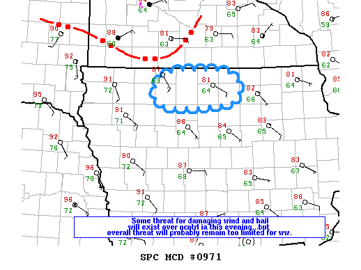
NOAA Storm Prediction Center Mesoscale Discussion 972
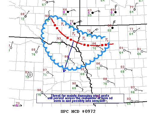
MD 0972 CONCERNING SEVERE THUNDERSTORM WATCH 267… FOR SERN SD…NWRN IA AND NERN NEB MESOSCALE DISCUSSION 0972 NWS STORM PREDICTION CENTER NORMAN OK 0857 PM CDT FRI JUN 17 2016 AREAS AFFECTED…SERN SD…NWRN IA AND NERN NEB CONCERNING…SEVERE THUNDERSTORM WATCH 267… VALID 180157Z – 180300Z THE SEVERE WEATHER THREAT FOR SEVERE THUNDERSTORM WATCH 267 CONTINUES. SUMMARY…STORMS ARE EXPECTED TO CONTINUE… Read more →