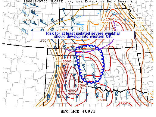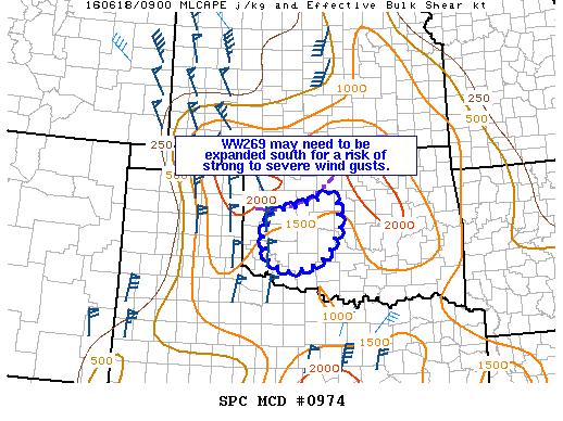
NOAA Storm Prediction Center Mesoscale Discussion 974
MD 0974 CONCERNING SEVERE THUNDERSTORM WATCH 269… FOR WESTERN OK MESOSCALE DISCUSSION 0974 NWS STORM PREDICTION CENTER NORMAN OK 0451 AM CDT SAT JUN 18 2016 AREAS AFFECTED…WESTERN OK CONCERNING…SEVERE THUNDERSTORM WATCH 269… VALID 180951Z – 181045Z THE SEVERE WEATHER THREAT FOR SEVERE THUNDERSTORM WATCH 269 CONTINUES. SUMMARY…RISK FOR STRONG TO ISOLATED SEVERE WIND GUSTS SHOULD CONTINUE THROUGH AT LEAST… Read more →