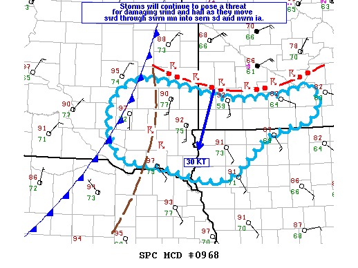
NOAA Storm Prediction Center Mesoscale Discussion 968
MD 0968 CONCERNING SEVERE THUNDERSTORM WATCH 267… FOR SWRN MN…SERN SD AND NWRN IA MESOSCALE DISCUSSION 0968 NWS STORM PREDICTION CENTER NORMAN OK 0613 PM CDT FRI JUN 17 2016 AREAS AFFECTED…SWRN MN…SERN SD AND NWRN IA CONCERNING…SEVERE THUNDERSTORM WATCH 267… VALID 172313Z – 180045Z THE SEVERE WEATHER THREAT FOR SEVERE THUNDERSTORM WATCH 267 CONTINUES. SUMMARY…ISOLATED DAMAGING WIND AND LARGE… Read more →