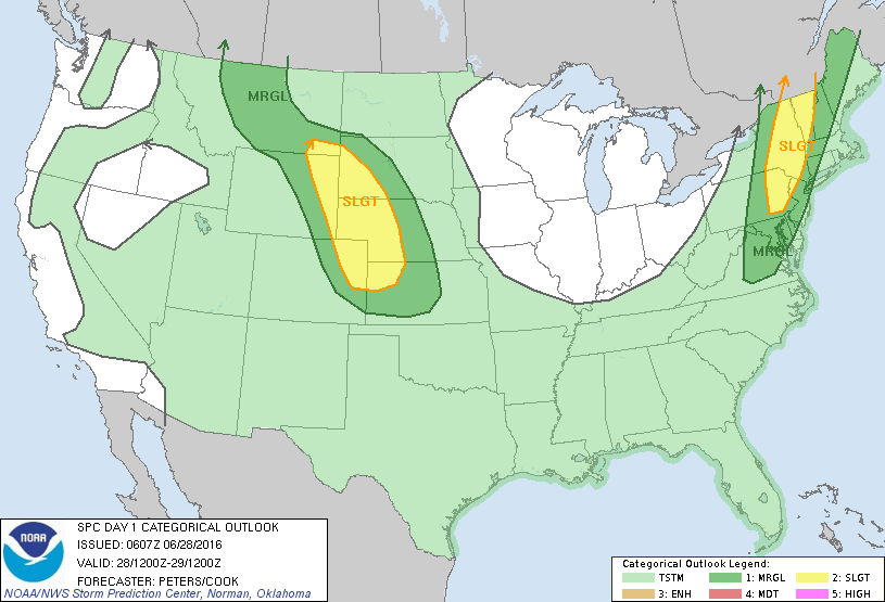
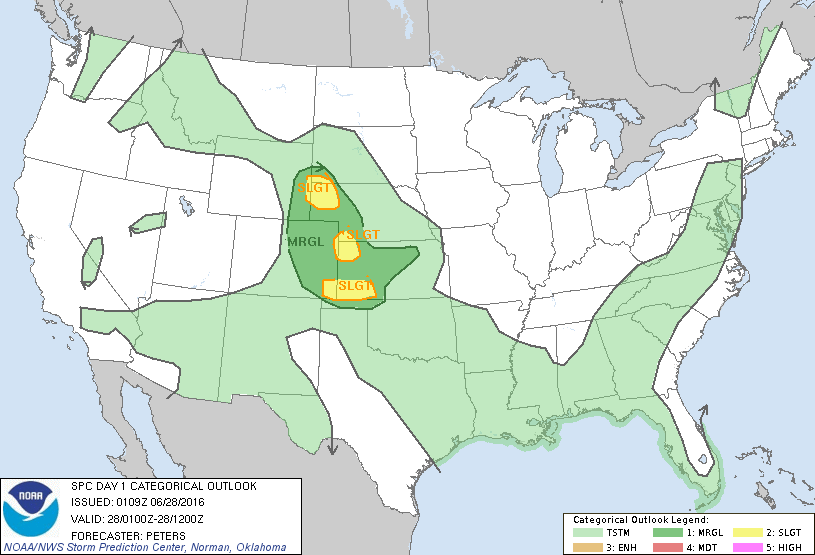
NOAA Storm Prediction Center Mesoscale Discussion 1069
MD 1069 CONCERNING SEVERE POTENTIAL…WATCH UNLIKELY FOR PORTIONS OF ERN KS MESOSCALE DISCUSSION 1069 NWS STORM PREDICTION CENTER NORMAN OK 0439 AM CDT TUE JUN 28 2016 AREAS AFFECTED…PORTIONS OF ERN KS CONCERNING…SEVERE POTENTIAL…WATCH UNLIKELY VALID 280939Z – 281145Z PROBABILITY OF WATCH ISSUANCE…5 PERCENT SUMMARY…A SMALL CLUSTER OF STRONG/LOCALLY SEVERE STORMS WILL CONTINUE MOVING SSEWD OVER THE NEXT 1-2 HOURS…WITH… Read more →