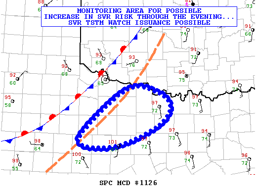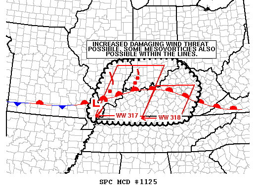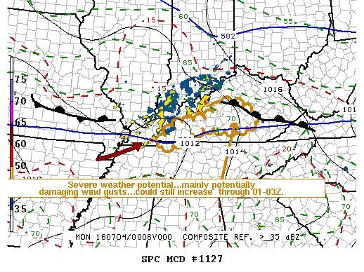
NOAA Storm Prediction Center Mesoscale Discussion 1127
MD 1127 CONCERNING TORNADO WATCH 317…318… FOR PARTS OF CENTRAL KENTUCKY MESOSCALE DISCUSSION 1127 NWS STORM PREDICTION CENTER NORMAN OK 0722 PM CDT SUN JUL 03 2016 AREAS AFFECTED…PARTS OF CENTRAL KENTUCKY CONCERNING…TORNADO WATCH 317…318… VALID 040022Z – 040115Z THE SEVERE WEATHER THREAT FOR TORNADO WATCH 317…318…CONTINUES. SUMMARY…THE RISK FOR POTENTIALLY DAMAGING WIND GUSTS MAY STILL INCREASE ACROSS PARTS OF… Read more →