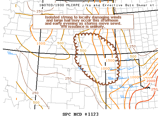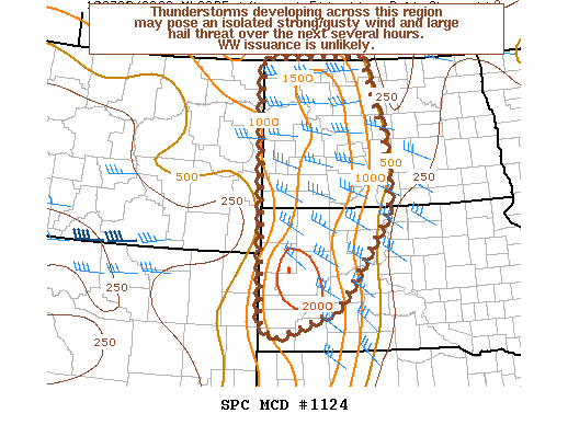
NOAA Storm Prediction Center Mesoscale Discussion 1124
MD 1124 CONCERNING SEVERE POTENTIAL…WATCH UNLIKELY FOR PORTIONS OF THE WRN DAKOTAS MESOSCALE DISCUSSION 1124 NWS STORM PREDICTION CENTER NORMAN OK 0338 PM CDT SUN JUL 03 2016 AREAS AFFECTED…PORTIONS OF THE WRN DAKOTAS CONCERNING…SEVERE POTENTIAL…WATCH UNLIKELY VALID 032038Z – 032245Z PROBABILITY OF WATCH ISSUANCE…20 PERCENT SUMMARY…THUNDERSTORMS DEVELOPING ACROSS THIS REGION MAY POSE A MARGINAL STRONG/GUSTY WIND AND LARGE HAIL… Read more →