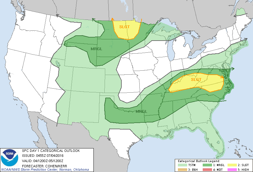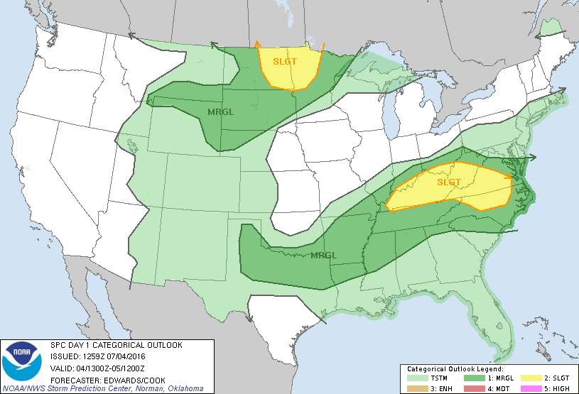
Storm Prediction Center Jul 4, 2016 Morning Outlook
SPC 1300Z Day 1 Outlook DAY 1 CONVECTIVE OUTLOOK NWS STORM PREDICTION CENTER NORMAN OK 0759 AM CDT MON JUL 04 2016 VALID 041300Z – 051200Z …THERE IS A SLGT RISK OF SEVERE THUNDERSTORMS PORTIONS NC/VA TO KY AREA… …THERE IS A SLGT RISK OF SEVERE THUNDERSTORMS PORTIONS ND/MN… …THERE IS A MRGL RISK OF SEVERE THUNDERSTORMS ELSEWHERE FROM CAROLINAS… Read more →