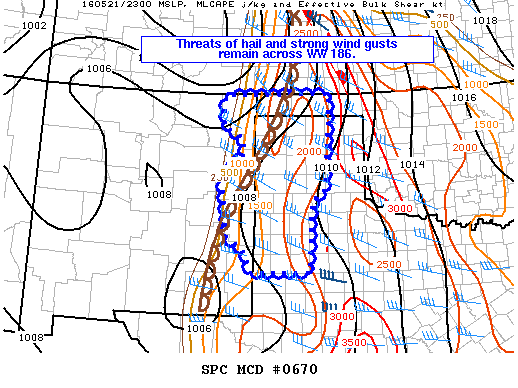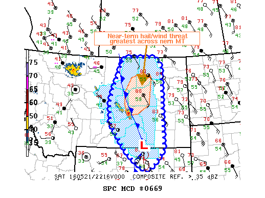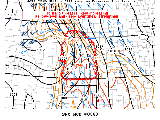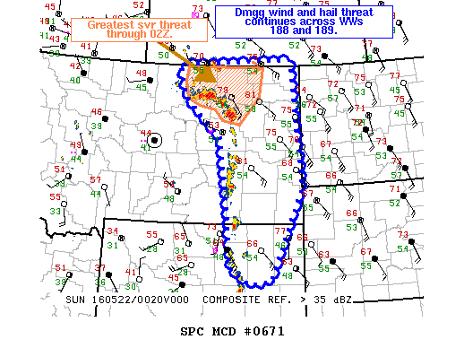
NOAA Storm Prediction Center Mesoscale Discussion 671
MD 0671 CONCERNING SEVERE THUNDERSTORM WATCH 188…189… FOR ERN MT….NERN WY MESOSCALE DISCUSSION 0671 NWS STORM PREDICTION CENTER NORMAN OK 0738 PM CDT SAT MAY 21 2016 AREAS AFFECTED…ERN MT….NERN WY CONCERNING…SEVERE THUNDERSTORM WATCH 188…189… VALID 220038Z – 220145Z THE SEVERE WEATHER THREAT FOR SEVERE THUNDERSTORM WATCH 188…189…CONTINUES. SUMMARY…THE THREAT FOR DMGG WINDS AND ISOLATED INSTANCES OF LARGE HAIL CONTINUES… Read more →