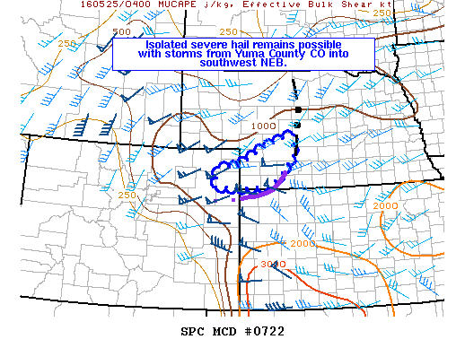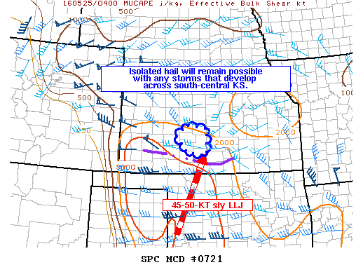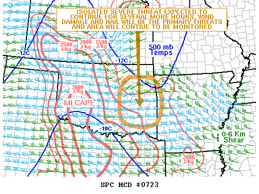
NOAA Storm Prediction Center Mesoscale Discussion 723
MD 0723 CONCERNING SEVERE POTENTIAL…WATCH POSSIBLE FOR ERN OK…WRN AR MESOSCALE DISCUSSION 0723 NWS STORM PREDICTION CENTER NORMAN OK 0113 AM CDT WED MAY 25 2016 AREAS AFFECTED…ERN OK…WRN AR CONCERNING…SEVERE POTENTIAL…WATCH POSSIBLE VALID 250613Z – 250845Z PROBABILITY OF WATCH ISSUANCE…40 PERCENT SUMMARY…AN ISOLATED SEVERE THREAT IS LIKELY TO CONTINUE FOR A COUPLE MORE HOURS ACROSS ERN OK. HAIL AND… Read more →