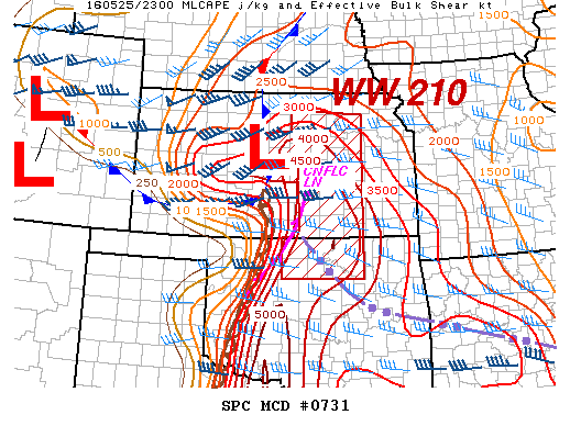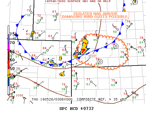
NOAA Storm Prediction Center Mesoscale Discussion 732
MD 0732 CONCERNING SEVERE POTENTIAL…WATCH POSSIBLE FOR SW/S-CNTRL NEB MESOSCALE DISCUSSION 0732 NWS STORM PREDICTION CENTER NORMAN OK 0723 PM CDT WED MAY 25 2016 AREAS AFFECTED…SW/S-CNTRL NEB CONCERNING…SEVERE POTENTIAL…WATCH POSSIBLE VALID 260023Z – 260200Z PROBABILITY OF WATCH ISSUANCE…40 PERCENT SUMMARY…SOME ISOLATED HAIL AND/OR DAMAGING WIND GUSTS ARE POSSIBLE IF THE ONGOING CONVECTIVE CLUSTER ACROSS SW NEB IS ABLE TO… Read more →