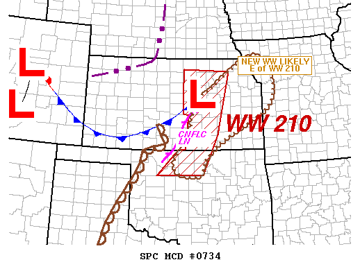
NOAA Storm Prediction Center Severe Thunderstorm Watch 211
WW 211 SEVERE TSTM IA NE SD 260135Z – 260700Z URGENT – IMMEDIATE BROADCAST REQUESTED SEVERE THUNDERSTORM WATCH NUMBER 211 NWS STORM PREDICTION CENTER NORMAN OK 835 PM CDT WED MAY 25 2016 THE NWS STORM PREDICTION CENTER HAS ISSUED A * SEVERE THUNDERSTORM WATCH FOR PORTIONS OF NORTHWEST IOWA SOUTH-CENTRAL THROUGH NORTHEAST NEBRASKA FAR SOUTHEAST SOUTH DAKOTA * EFFECTIVE… Read more →