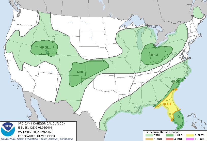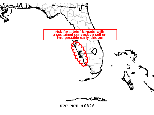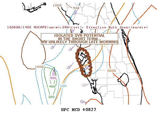
NOAA Storm Prediction Center Mesoscale Discussion 827
MD 0827 CONCERNING SEVERE POTENTIAL…WATCH UNLIKELY FOR PORTIONS OF THE W COAST OF FL MESOSCALE DISCUSSION 0827 NWS STORM PREDICTION CENTER NORMAN OK 0939 AM CDT MON JUN 06 2016 AREAS AFFECTED…PORTIONS OF THE W COAST OF FL CONCERNING…SEVERE POTENTIAL…WATCH UNLIKELY VALID 061439Z – 061615Z PROBABILITY OF WATCH ISSUANCE…20 PERCENT SUMMARY…THERE WILL EXIST A RISK FOR ISOLATED SVR TSTMS ACROSS… Read more →