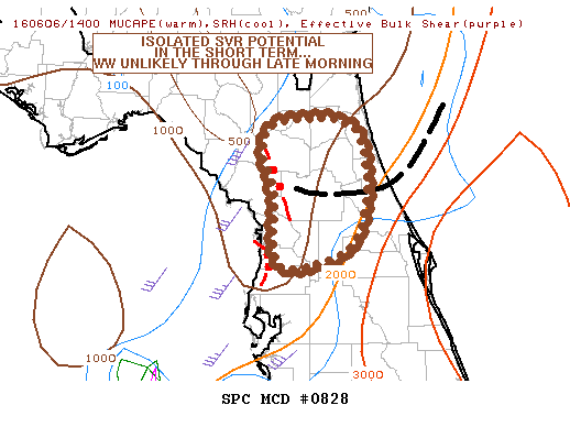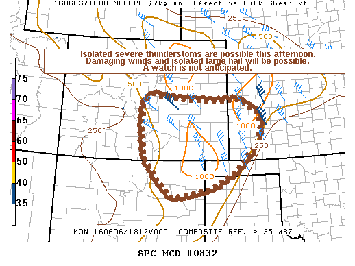
NOAA Storm Prediction Center Mesoscale Discussion 832
MD 0832 CONCERNING SEVERE POTENTIAL…WATCH UNLIKELY FOR PORTIONS OF S-CENTRAL/SERN CO…SWRN KS…OK/TX PANHANDLES…NERN NM MESOSCALE DISCUSSION 0832 NWS STORM PREDICTION CENTER NORMAN OK 0133 PM CDT MON JUN 06 2016 AREAS AFFECTED…PORTIONS OF S-CENTRAL/SERN CO…SWRN KS…OK/TX PANHANDLES…NERN NM CONCERNING…SEVERE POTENTIAL…WATCH UNLIKELY VALID 061833Z – 062100Z PROBABILITY OF WATCH ISSUANCE…20 PERCENT SUMMARY…ISOLATED SEVERE THUNDERSTORMS ARE EXPECTED THIS AFTERNOON POSING A RISK… Read more →