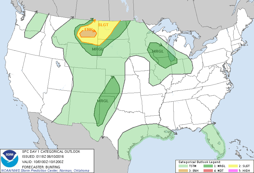
Storm Prediction Center Jun 10, 2016 UTC Evening Outlook
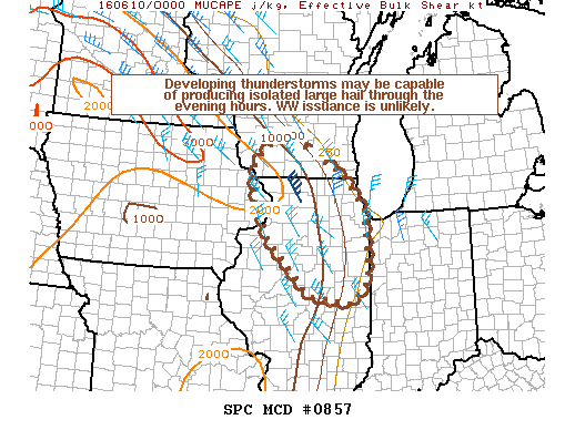
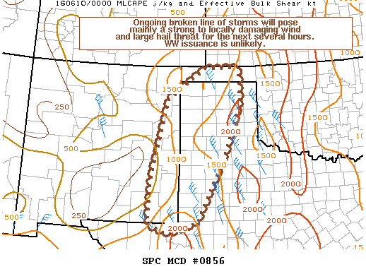
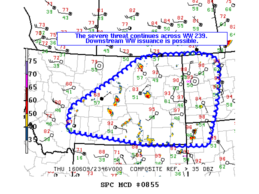
SPC 0100Z Day 1 Outlook DAY 1 CONVECTIVE OUTLOOK NWS STORM PREDICTION CENTER NORMAN OK 0818 PM CDT THU JUN 09 2016 VALID 100100Z – 101200Z …THERE IS AN ENH RISK OF SEVERE THUNDERSTORMS OVER A SMALL PORTION OF EAST-CENTRAL MT… …THERE IS A SLGT RISK OF SEVERE THUNDERSTORMS FROM PORTIONS OF EASTERN MT INTO WRN ND/NWRN SD… …THERE IS… Read more →