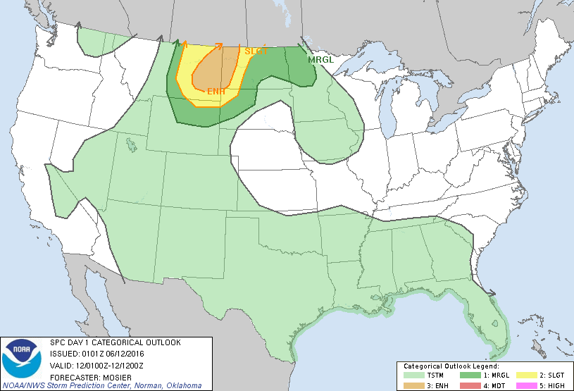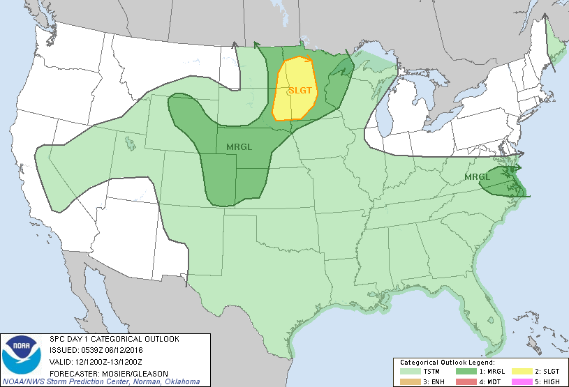
Storm Prediction Center Jun 12, 2016 Early Morning UTC Day 1 Convective Outlook
SPC 1200Z Day 1 Outlook DAY 1 CONVECTIVE OUTLOOK NWS STORM PREDICTION CENTER NORMAN OK 1239 AM CDT SUN JUN 12 2016 VALID 121200Z – 131200Z …THERE IS A SLGT RISK OF SEVERE THUNDERSTORMS FOR THE ERN DAKOTAS AND WRN/CNTRL MN… …THERE IS A MRGL RISK OF SEVERE THUNDERSTORMS FOR PORTIONS OF THE UPPER MS VALLEY…CNTRL HIGH PLAINS…AND CNTRL PLAINS…… Read more →