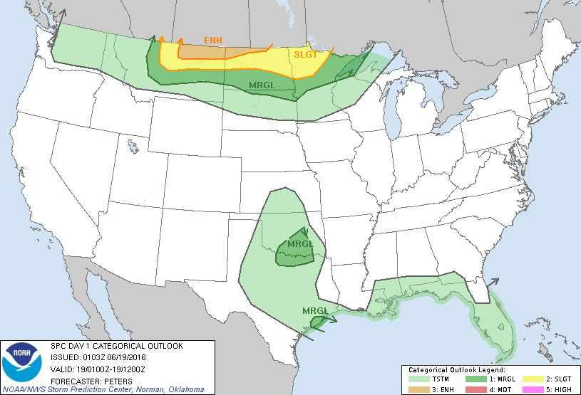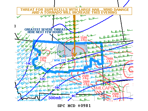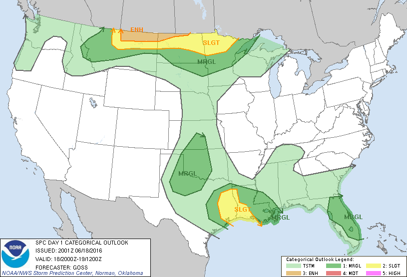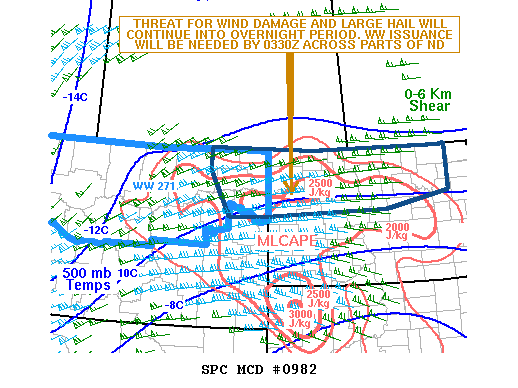
NOAA Storm Prediction Center Mesoscale Discussion 982
MD 0982 CONCERNING SEVERE THUNDERSTORM WATCH 271… FOR NE MT…ND MESOSCALE DISCUSSION 0982 NWS STORM PREDICTION CENTER NORMAN OK 0958 PM CDT SAT JUN 18 2016 AREAS AFFECTED…NE MT…ND CONCERNING…SEVERE THUNDERSTORM WATCH 271… VALID 190258Z – 190400Z THE SEVERE WEATHER THREAT FOR SEVERE THUNDERSTORM WATCH 271 CONTINUES. SUMMARY…THE THREAT FOR WIND DAMAGE AND LARGE HAIL WILL CONTINUE ACROSS NE MT… Read more →