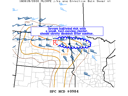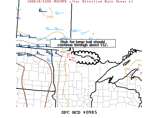
NOAA Storm Prediction Center Mesoscale Discussion 985
MD 0985 CONCERNING SEVERE POTENTIAL…WATCH UNLIKELY FOR FAR NORTHERN MN MESOSCALE DISCUSSION 0985 NWS STORM PREDICTION CENTER NORMAN OK 0746 AM CDT SUN JUN 19 2016 AREAS AFFECTED…FAR NORTHERN MN CONCERNING…SEVERE POTENTIAL…WATCH UNLIKELY VALID 191246Z – 191415Z PROBABILITY OF WATCH ISSUANCE…20 PERCENT SUMMARY…A RISK FOR MAINLY ISOLATED LARGE HAIL SHOULD PERSIST THROUGH ABOUT 15Z ALONG THE INTERNATIONAL BORDER. DISCUSSION…WHILE A… Read more →