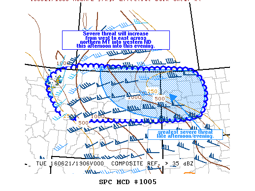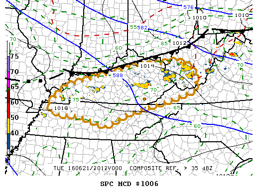
NOAA Storm Prediction Center Mesoscale Discussion 1006
MD 1006 CONCERNING SEVERE THUNDERSTORM WATCH 279… FOR KENTUCKY…NRN TN…SRN WEST VIRGINIA MESOSCALE DISCUSSION 1006 NWS STORM PREDICTION CENTER NORMAN OK 0326 PM CDT TUE JUN 21 2016 AREAS AFFECTED…KENTUCKY…NRN TN…SRN WEST VIRGINIA CONCERNING…SEVERE THUNDERSTORM WATCH 279… VALID 212026Z – 212200Z THE SEVERE WEATHER THREAT FOR SEVERE THUNDERSTORM WATCH 279 CONTINUES. SUMMARY…AT LEAST SOME RISK FOR SEVERE HAIL/WIND GUSTS CONTINUES…BUT… Read more →