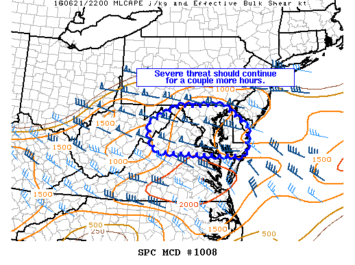
NOAA Storm Prediction Center Mesoscale Discussion 1008
MD 1008 CONCERNING SEVERE THUNDERSTORM WATCH 278… FOR PORTIONS OF MD…EASTERN WV…NORTHERN VA…DC…AND DE MESOSCALE DISCUSSION 1008 NWS STORM PREDICTION CENTER NORMAN OK 0530 PM CDT TUE JUN 21 2016 AREAS AFFECTED…PORTIONS OF MD…EASTERN WV…NORTHERN VA…DC…AND DE CONCERNING…SEVERE THUNDERSTORM WATCH 278… VALID 212230Z – 220000Z THE SEVERE WEATHER THREAT FOR SEVERE THUNDERSTORM WATCH 278 CONTINUES. SUMMARY…GREATEST SEVERE THREAT WILL EXIST… Read more →