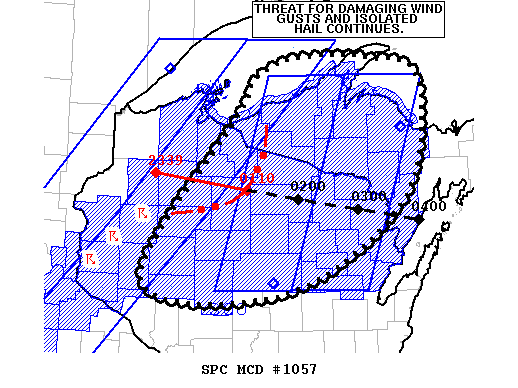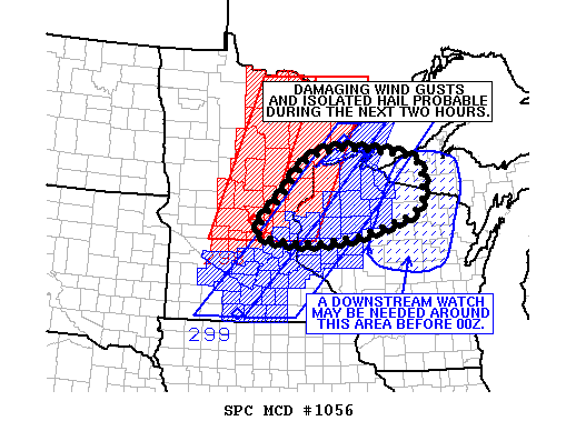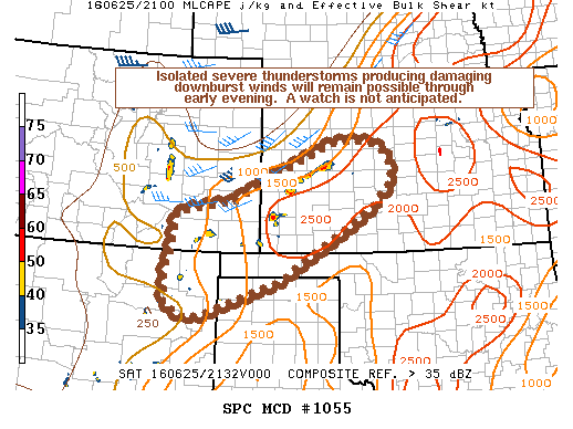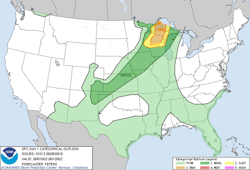
Storm Prediction Center Jun 26, 2016 UTC Evening Outlook
SPC 0100Z Day 1 Outlook DAY 1 CONVECTIVE OUTLOOK NWS STORM PREDICTION CENTER NORMAN OK 0801 PM CDT SAT JUN 25 2016 VALID 260100Z – 261200Z …THERE IS AN ENH RISK OF SEVERE THUNDERSTORMS ACROSS PART OF NORTHERN WI AND WESTERN UPPER MI… …THERE IS A SLGT RISK OF SEVERE THUNDERSTORMS SURROUNDING THE ENH RISK AREA ACROSS A PORTION OF… Read more →