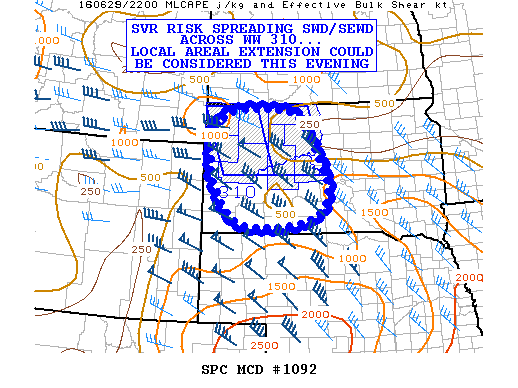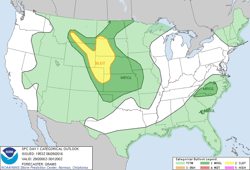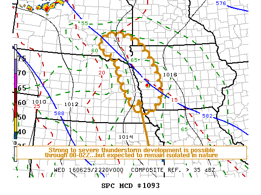
NOAA Storm Prediction Center Mesoscale Discussion 1093
MD 1093 CONCERNING SEVERE POTENTIAL…WATCH UNLIKELY FOR ERN NEBRASKA…WRN IA…SERN SOUTH DAKOTA…FAR SWRN MN MESOSCALE DISCUSSION 1093 NWS STORM PREDICTION CENTER NORMAN OK 0536 PM CDT WED JUN 29 2016 AREAS AFFECTED…ERN NEBRASKA…WRN IA…SERN SOUTH DAKOTA…FAR SWRN MN CONCERNING…SEVERE POTENTIAL…WATCH UNLIKELY VALID 292236Z – 300030Z PROBABILITY OF WATCH ISSUANCE…20 PERCENT SUMMARY…ISOLATED STRONG TO SEVERE STORM DEVELOPMENT IS POSSIBLE INTO THE… Read more →