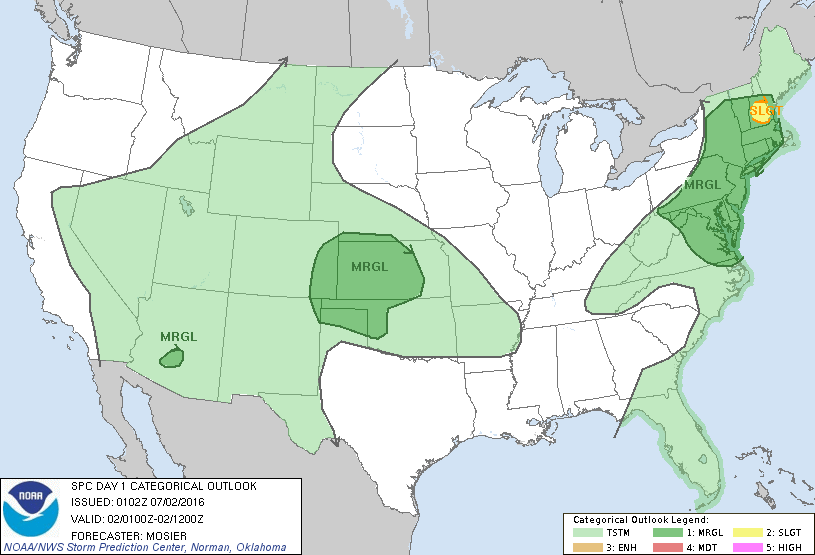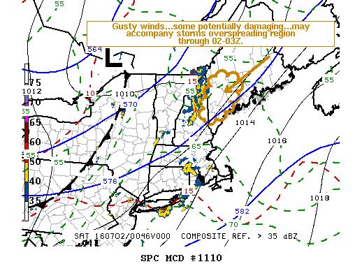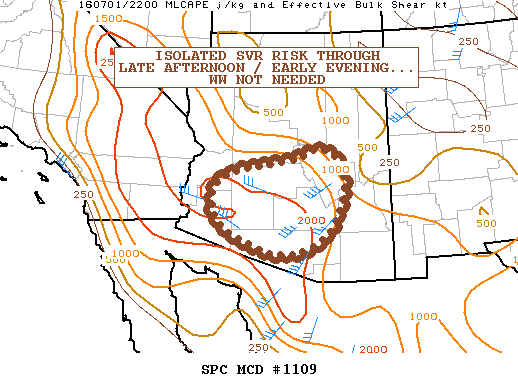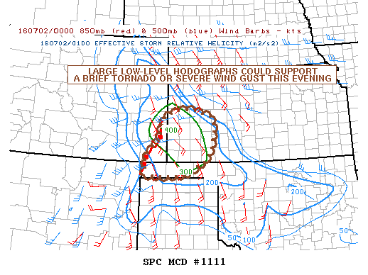
NOAA Storm Prediction Center Mesoscale Discussion 1111
MD 1111 CONCERNING SEVERE POTENTIAL…WATCH UNLIKELY FOR SOUTHWESTERN KANSAS…FAR SOUTHEAST COLORADO…OKLAHOMA PANHANDLE MESOSCALE DISCUSSION 1111 NWS STORM PREDICTION CENTER NORMAN OK 0848 PM CDT FRI JUL 01 2016 AREAS AFFECTED…SOUTHWESTERN KANSAS…FAR SOUTHEAST COLORADO…OKLAHOMA PANHANDLE CONCERNING…SEVERE POTENTIAL…WATCH UNLIKELY VALID 020148Z – 020345Z PROBABILITY OF WATCH ISSUANCE…20 PERCENT SUMMARY…A SEVERE WIND GUST AND BRIEF TORNADO EMBEDDED WITHIN A DEVELOPING QUASI-LINEAR CONVECTIVE SYSTEM… Read more →