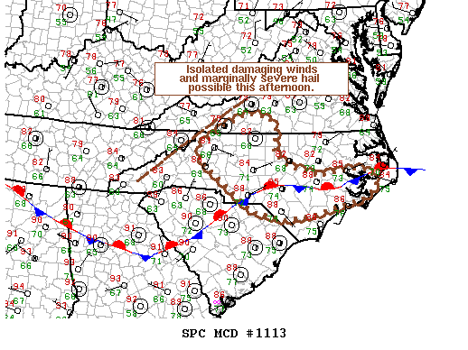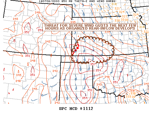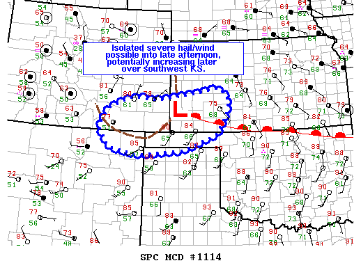
NOAA Storm Prediction Center Mesoscale Discussion 1114
MD 1114 CONCERNING SEVERE POTENTIAL…WATCH POSSIBLE FOR RATON MESA TO SOUTHWEST KS MESOSCALE DISCUSSION 1114 NWS STORM PREDICTION CENTER NORMAN OK 1255 PM CDT SAT JUL 02 2016 AREAS AFFECTED…RATON MESA TO SOUTHWEST KS CONCERNING…SEVERE POTENTIAL…WATCH POSSIBLE VALID 021755Z – 022000Z PROBABILITY OF WATCH ISSUANCE…40 PERCENT SUMMARY…CONVECTION SHOULD INCREASE IN COVERAGE ACROSS THIS REGION BY LATE AFTERNOON WITH GENERALLY AN… Read more →