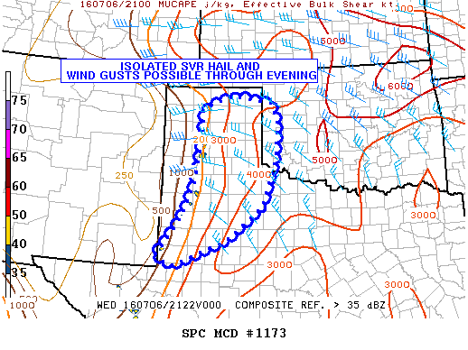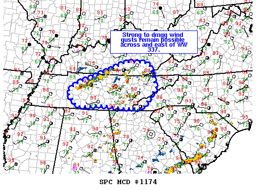
NOAA Storm Prediction Center Mesoscale Discussion 1174
MD 1174 CONCERNING SEVERE THUNDERSTORM WATCH 337… FOR SERN KY…MIDDLE/ERN TN…FAR SWRN VA…FAR WRN NC MESOSCALE DISCUSSION 1174 NWS STORM PREDICTION CENTER NORMAN OK 0448 PM CDT WED JUL 06 2016 AREAS AFFECTED…SERN KY…MIDDLE/ERN TN…FAR SWRN VA…FAR WRN NC CONCERNING…SEVERE THUNDERSTORM WATCH 337… VALID 062148Z – 062245Z THE SEVERE WEATHER THREAT FOR SEVERE THUNDERSTORM WATCH 337 CONTINUES. SUMMARY…MCS MOVING THROUGH… Read more →