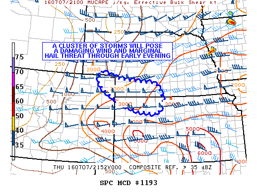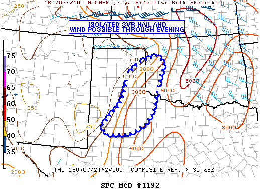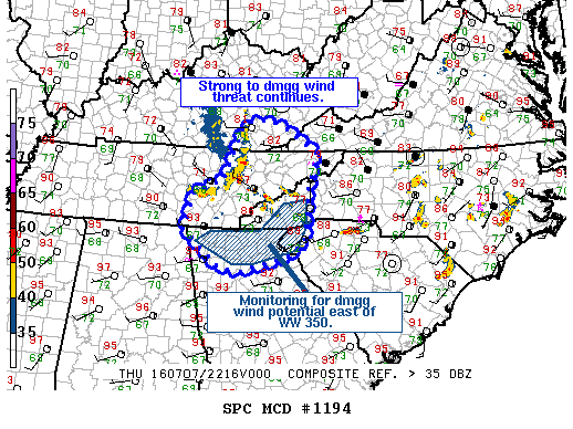
NOAA Storm Prediction Center Mesoscale Discussion 1194
MD 1194 CONCERNING SEVERE THUNDERSTORM WATCH 350… FOR ERN TN…SERN KY…FAR SWRN VA…FAR WRN CAROLINAS…NRN GA MESOSCALE DISCUSSION 1194 NWS STORM PREDICTION CENTER NORMAN OK 0537 PM CDT THU JUL 07 2016 AREAS AFFECTED…ERN TN…SERN KY…FAR SWRN VA…FAR WRN CAROLINAS…NRN GA CONCERNING…SEVERE THUNDERSTORM WATCH 350… VALID 072237Z – 072330Z THE SEVERE WEATHER THREAT FOR SEVERE THUNDERSTORM WATCH 350 CONTINUES. SUMMARY…STRONG… Read more →