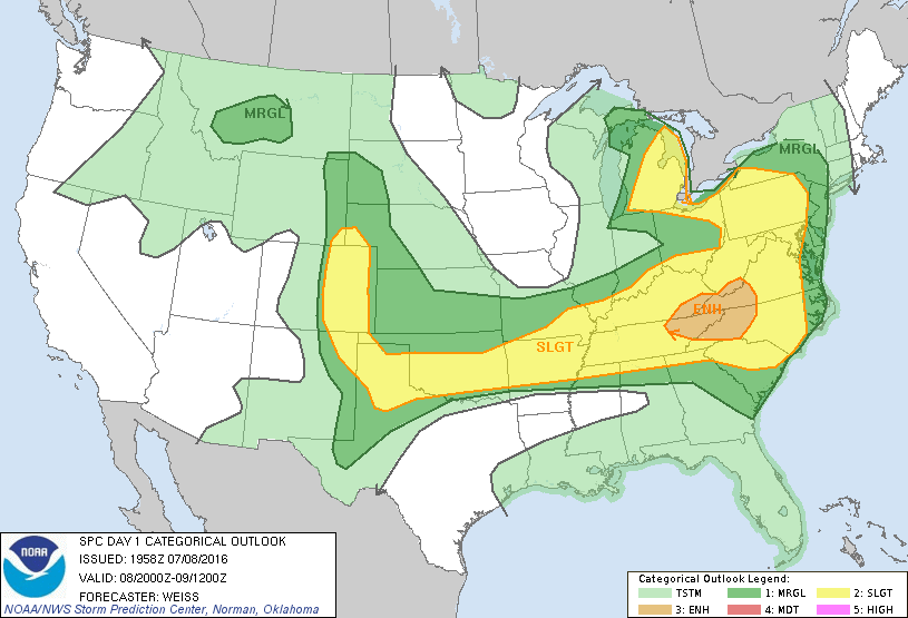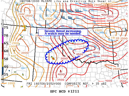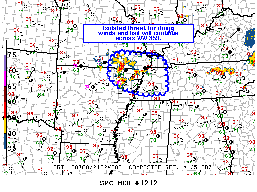
NOAA Storm Prediction Center Mesoscale Discussion 1212
MD 1212 CONCERNING SEVERE THUNDERSTORM WATCH 359… FOR SERN MO…NERN AR…WRN TN…FAR SWRN KY MESOSCALE DISCUSSION 1212 NWS STORM PREDICTION CENTER NORMAN OK 0442 PM CDT FRI JUL 08 2016 AREAS AFFECTED…SERN MO…NERN AR…WRN TN…FAR SWRN KY CONCERNING…SEVERE THUNDERSTORM WATCH 359… VALID 082142Z – 082245Z THE SEVERE WEATHER THREAT FOR SEVERE THUNDERSTORM WATCH 359 CONTINUES. SUMMARY…THREAT FOR ISOLATED SVR WIND… Read more →