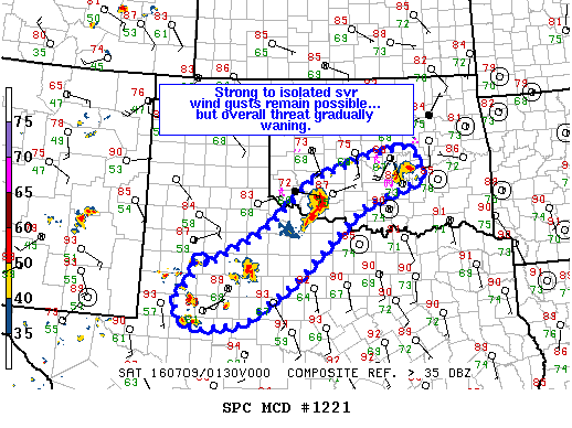
NOAA Storm Prediction Center Mesoscale Discussion 1221
MD 1221 CONCERNING SEVERE THUNDERSTORM WATCH 362… FOR SWRN/CNTRL OK…NW AND W-CNTRL TX MESOSCALE DISCUSSION 1221 NWS STORM PREDICTION CENTER NORMAN OK 0844 PM CDT FRI JUL 08 2016 AREAS AFFECTED…SWRN/CNTRL OK…NW AND W-CNTRL TX CONCERNING…SEVERE THUNDERSTORM WATCH 362… VALID 090144Z – 090245Z THE SEVERE WEATHER THREAT FOR SEVERE THUNDERSTORM WATCH 362 CONTINUES. SUMMARY…ISOLATED SVR WIND GUSTS REMAIN POSSIBLE WITHIN… Read more →