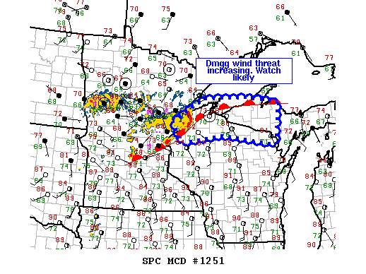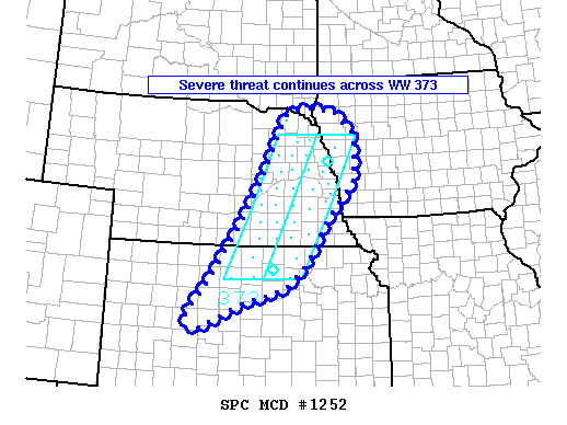
NOAA Storm Prediction Center Mesoscale Discussion 1252
MD 1252 CONCERNING SEVERE THUNDERSTORM WATCH 373… FOR EASTERN NEBRASKA…NORTHERN/CENTRAL KANSAS…AND WESTERN IOWA MESOSCALE DISCUSSION 1252 NWS STORM PREDICTION CENTER NORMAN OK 0725 PM CDT MON JUL 11 2016 AREAS AFFECTED…EASTERN NEBRASKA…NORTHERN/CENTRAL KANSAS…AND WESTERN IOWA CONCERNING…SEVERE THUNDERSTORM WATCH 373… VALID 120025Z – 120130Z THE SEVERE WEATHER THREAT FOR SEVERE THUNDERSTORM WATCH 373 CONTINUES. SUMMARY…THE SEVERE THREAT CONTINUES ACROSS WW 373…. Read more →