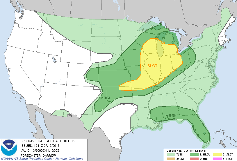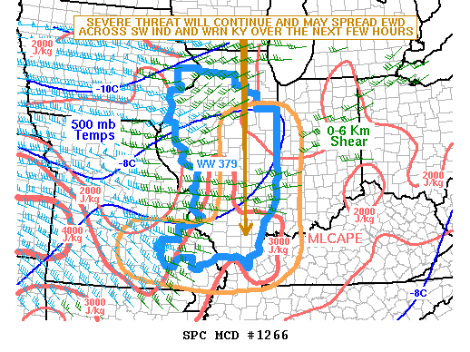
NOAA Storm Prediction Center Mesoscale Discussion 1266
MD 1266 CONCERNING SEVERE THUNDERSTORM WATCH 379… FOR IL…SE MO AND WRN KY MESOSCALE DISCUSSION 1266 NWS STORM PREDICTION CENTER NORMAN OK 0508 PM CDT WED JUL 13 2016 AREAS AFFECTED…IL…SE MO AND WRN KY CONCERNING…SEVERE THUNDERSTORM WATCH 379… VALID 132208Z – 140015Z THE SEVERE WEATHER THREAT FOR SEVERE THUNDERSTORM WATCH 379 CONTINUES. SUMMARY…THE SEVERE THREAT WILL CONTINUE FOR SEVERAL… Read more →