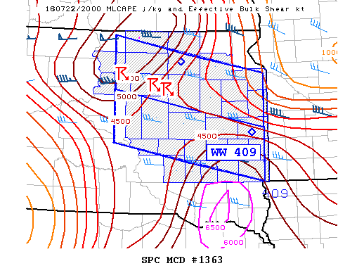
NOAA Storm Prediction Center Mesoscale Discussion 1364
MD 1364 CONCERNING SEVERE THUNDERSTORM WATCH 409…410… FOR DAKOTAS MESOSCALE DISCUSSION 1364 NWS STORM PREDICTION CENTER NORMAN OK 0635 PM CDT FRI JUL 22 2016 AREAS AFFECTED…DAKOTAS CONCERNING…SEVERE THUNDERSTORM WATCH 409…410… VALID 222335Z – 230030Z THE SEVERE WEATHER THREAT FOR SEVERE THUNDERSTORM WATCH 409…410…CONTINUES. SUMMARY…LARGE HAIL AND GUSTY WINDS ARE EXPECTED WITH THUNDERSTORM CLUSTERS THIS EVENING. DISCUSSION…CONVECTION IS GRADUALLY EXPANDING… Read more →