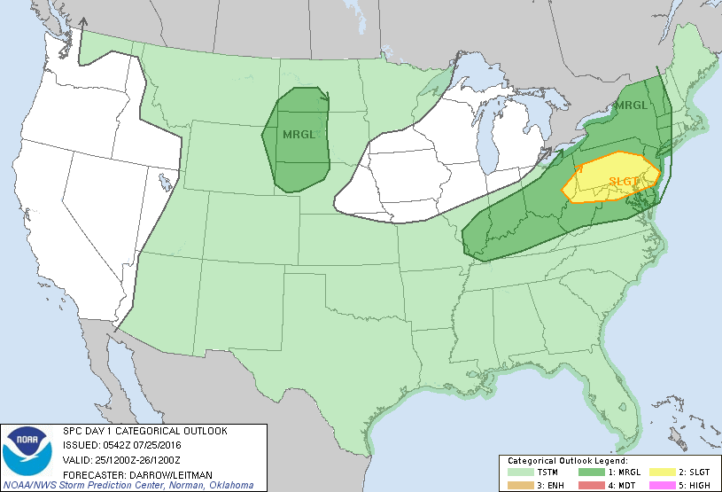
Storm Prediction Center Jul 25, 2016 Early Morning UTC Day 1 Convective Outlook
SPC 1200Z Day 1 Outlook DAY 1 CONVECTIVE OUTLOOK NWS STORM PREDICTION CENTER NORMAN OK 1242 AM CDT MON JUL 25 2016 VALID 251200Z – 261200Z …THERE IS A SLGT RISK OF SEVERE THUNDERSTORMS ACROSS PORTIONS OF THE OH VALLEY INTO THE NRN MIDDLE ATLANTIC… …THERE IS A MRGL RISK OF SEVERE THUNDERSTORMS FROM THE OH VALLEY INTO WRN NEW… Read more →