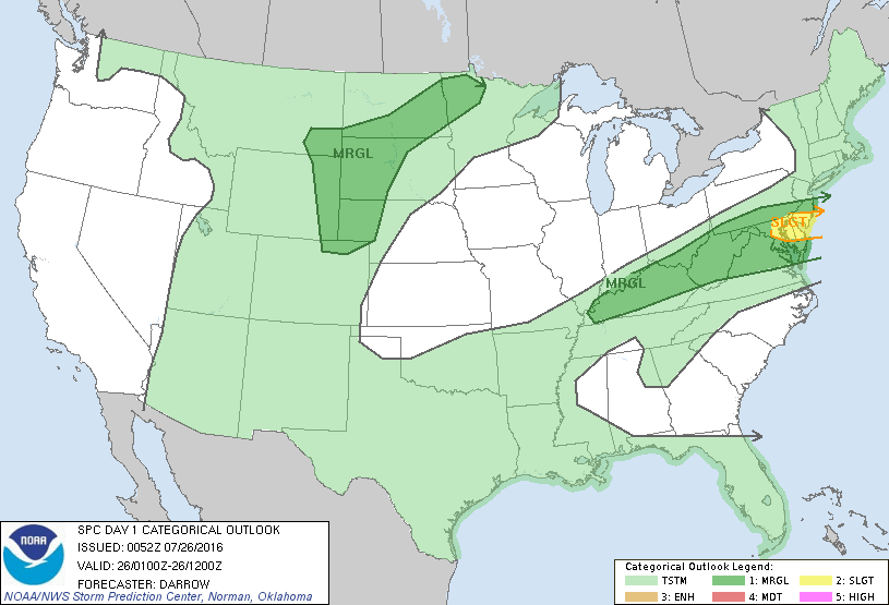
Storm Prediction Center Jul 26, 2016 Early Morning UTC Day 1 Convective Outlook
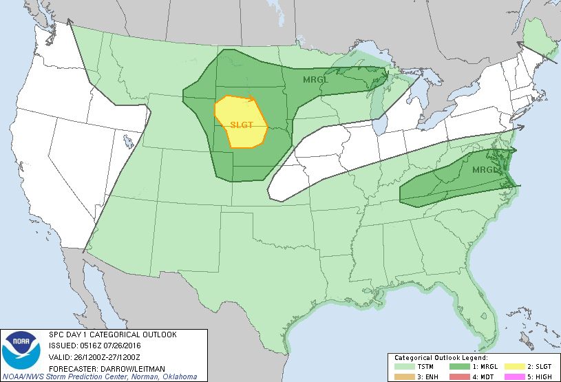
SPC 1200Z Day 1 Outlook DAY 1 CONVECTIVE OUTLOOK NWS STORM PREDICTION CENTER NORMAN OK 1216 AM CDT TUE JUL 26 2016 VALID 261200Z – 271200Z …THERE IS A SLGT RISK OF SEVERE THUNDERSTORMS ACROSS PARTS OF SD AND NEBRASKA… …THERE IS A MRGL RISK OF SEVERE THUNDERSTORMS ACROSS PARTS OF THE NORTHERN AND CENTRAL PLAINS… …THERE IS A MRGL… Read more →