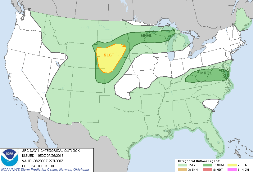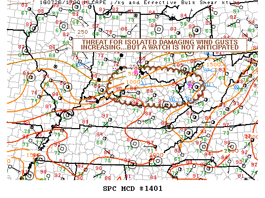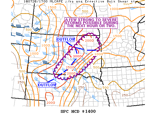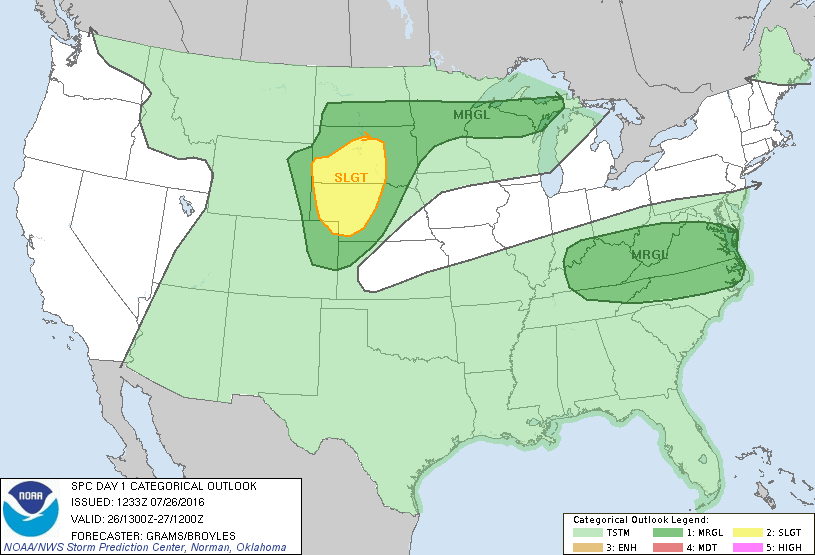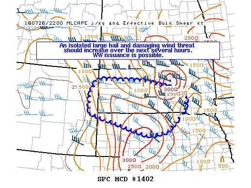
NOAA Storm Prediction Center Mesoscale Discussion 1402
MD 1402 CONCERNING SEVERE POTENTIAL…WATCH POSSIBLE FOR PORTIONS OF FAR ERN WY…SRN SD…AND NRN/WRN NEB MESOSCALE DISCUSSION 1402 NWS STORM PREDICTION CENTER NORMAN OK 0532 PM CDT TUE JUL 26 2016 AREAS AFFECTED…PORTIONS OF FAR ERN WY…SRN SD…AND NRN/WRN NEB CONCERNING…SEVERE POTENTIAL…WATCH POSSIBLE VALID 262232Z – 270030Z PROBABILITY OF WATCH ISSUANCE…40 PERCENT SUMMARY…AN ISOLATED LARGE HAIL AND DAMAGING WIND THREAT… Read more →