Good morning, everyone! Please take a moment to give this a read…Based on the latest guidance from the SPC's SSEO…
Posted by Nick Lilja WDAM on Thursday, March 10, 2016
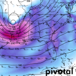
The Models
SSEO:

HRRR:

Usually, clearing one hurdle at a time is the best way to handle weather, but in this case, it is important to jump on this before the preoccupation with flooding leads to a missed opportunity to warn about the threat for more severe weather. The Setup A cut-off Low lifts out of Texas and into Mississippi and Tennessee as a… Read more →
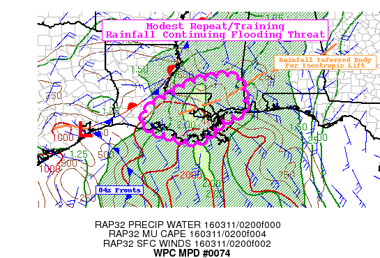
The Weather Prediction Center is still concerned about some flooding across the southern Louisiana, Mississippi coasts through the next few hours. As the storms continue to train over the same area, places dealing with flooding already as well as flood-prone areas could see an additional few inches of rain before the current batch of storms move out of the area…. Read more →

SPC 0100Z Day 1 Outlook DAY 1 CONVECTIVE OUTLOOK NWS STORM PREDICTION CENTER NORMAN OK 0654 PM CST THU MAR 10 2016 VALID 110100Z – 111200Z …THERE IS A MRGL RISK OF SEVERE THUNDERSTORMS ACROSS THE CENTRAL GULF COAST… …SUMMARY… AN ISOLATED DAMAGING WIND AND/OR TORNADO RISK WILL EXIST TONIGHT MAINLY ACROSS SOUTHERN PORTIONS OF LOUISIANA AND MISSISSIPPI AND THE… Read more →

SPC 2000Z Day 1 Outlook DAY 1 CONVECTIVE OUTLOOK NWS STORM PREDICTION CENTER NORMAN OK 0200 PM CST THU MAR 10 2016 VALID 102000Z – 111200Z …THERE IS A MRGL RISK OF SEVERE THUNDERSTORMS FOR A LARGE PORTION OF THE LOWER MS VALLEY… …THERE IS A MRGL RISK OF SEVERE THUNDERSTORMS ACROSS PORTIONS OF COASTAL S TX… …SUMMARY… AN ISOLATED… Read more →
Good morning, everyone! Please take a moment to give this a read…Based on the latest guidance from the SPC's SSEO…
Posted by Nick Lilja WDAM on Thursday, March 10, 2016
SSEO:
HRRR:

